Papio NRD Names New Reservoirs & Recreation Areas

The Papio NRD Board of Directors has named four of its upcoming flood reduction reservoirs and recreation areas that will be located in the Omaha metro.

Mad Bear flood reduction reservoir under construction near 168th & Giles Road in Gretna.

The projects will feature no-wake lakes (reservoirs) and recreation amenities, including trails, kayak/canoe launches, fishing access, and picnic areas.

The names include:

  • Marlin Petermann Recreation Area – under construction near 180th and Fort Street in Omaha. Estimated to be complete spring of 2027.
  • Mad Bear Recreation Area – under construction near 168th and Giles Road in Gretna. Estimated to be complete fall of 2025.
  • Forest City Recreation Area – under construction near 204th and Schram Road in Gretna. Estimated to be complete late summer of 2025.
  • Dr. Susan La Flesche Picotte Recreation Area – to be located near 192nd and Giles Road in Gretna. Construction estimated to begin in five years.

“As a veteran of the United States Army, I felt strongly that one of the new flood reduction reservoirs and recreation areas be named after the first Native American to be awarded the Congressional Medal of Honor: Sergeant Mad Bear,” said Papio NRD Board vice chairman, Dr. Larry Bradley. “Sgt. Mad Bear performed some of his meritorious duties in Nebraska. As I was raised by Oglala Lakota and am part Native American myself, naming these sites to honor notable, local Indigenous peoples is an important and meaningful tribute. In addition, recognizing the late Marlin Petermann is richly deserved, as his work at the Papio NRD directly enabled the construction of these (and many other) reservoirs and the naming of them possible,” said Dr. Bradley.

“I am honored to participate in the naming of two flood mitigation reservoirs and recreation sites after historic Native Americans that made a significant difference in Nebraska,” said Papio NRD Board Director, Jim Thompson. “These truly deserving individuals will be recognized by current and future generations who utilize these sites. Naming another reservoir and recreation area after the late Marlin Petermann is a most appropriate recognition due to his lifelong dedication and service to Nebraska’s natural resources,” said Thompson.

In response to public input for name recommendations, the board named the fourth Papio NRD reservoir and recreation area Forest City Recreation Area due to its historical significance to the City of Gretna. The name recognizes the area’s history, as the town was originally known as Forest City before the railroad’s arrival shifted development to present-day Gretna.


MoPac Trail Near Springfield to Temporarily Close

MoPac Trail south of Springfield.

The MoPac Trail near Springfield, from Buffalo Road to Riha Road, will close on Monday, March 10th. The Papio NRD is working with OPPD to prepare for construction to upgrade a transmission line along the east edge of the MoPac Trail south of Springfield.

The first step will be clearing of brush and trees along the trail to prepare the site for construction. Tree crews will begin work in the middle of March and will be on site for a few weeks. Updates will be provided based on the status of work which will be determined by weather and site conditions.

If you have questions, please contact the Papio NRD at 402-444-6222 or OPPD at 402-881-8280.


River Access Parks to Close Friday for Season

The Papio NRD will close all river access parks to the Elkhorn and Platte rivers for the season on November 1st.

The access sites include Elkhorn Crossing, Graske Crossing, West Maple Road, and Platte River Landing.

The access sites will reopen April 1st, 2025.

Elkhorn Crossing Campsites to Open Saturday – RV Site Upgrades Complete

Campers rejoice!

All RV and camping sites at Elkhorn Crossing Recreation Area will open at 8:00 a.m. on Saturday, August 31st, following the installation of water and electric for RV site hook-ups. These are significant upgrades to the park we are excited to offer to make your camping experience even better.

The ten RV sites offer 50-amp electrical service. The campsite does not contain a dump station.

Campsite Registration Fees

All RV and camping sites can only be reserved for seven consecutive days. Campers register at the campground registration kiosk upon entering the facility.

  • RV sites – $30 per night (non-refundable)
  • Tent sites – $15 per night
  • Group camping – $10 per night/per tent

After Saturday’s opening at 8:00 a.m., Elkhorn Crossing (located at the intersection of 252nd & Bennington Road) will open daily at 6:00 a.m. to 10:00 p.m. A reminder to campers the boat ramp is closed from 10:00 p.m. to 6:00 a.m. with no boat launching or arrivals allowed during those hours.

The public access site will close for the season on November 1.


Platte River Bridge Trail Grand Opening

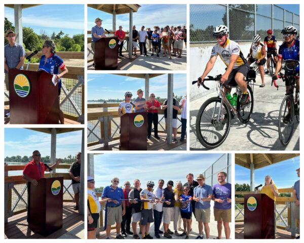
Today was a big day for trail users!

The Papio NRD, local government agencies, and recreation enthusiasts celebrated the grand opening of the Platte River Bridge Trail, a project two decades in the making.

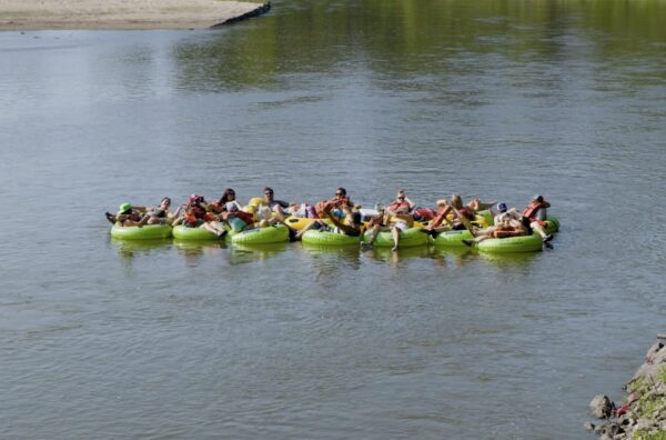
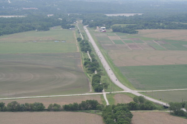
The Platte River Bridge Trail provides greater safety for those who use the bridge and increased recreational opportunities for trail users. The trail connects Sarpy County to Cass County along the Highway 34 / Highway 75 bridge.

“Trails are designed to provide recreation, active transportation, and access to natural resources,” said Papio NRD Natural Resources Planner Eric Williams. “The Platte River Bridge Trail excels at all three of those objectives and represents a boundary-breaking accomplishment for regional connectivity,” said Williams.

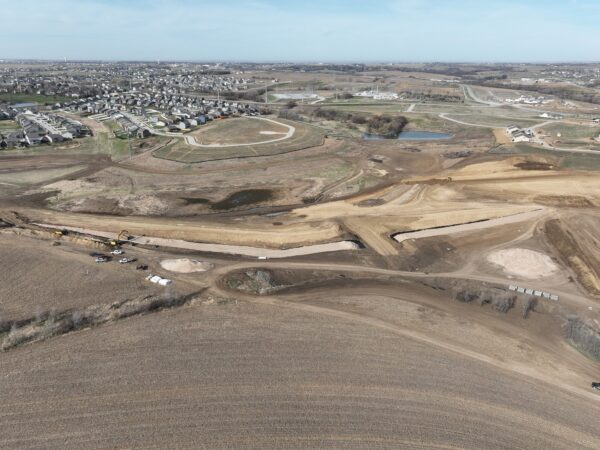
Williams says additional projects are in progress to connect with the Platte River bridge and continue the expansion of trail benefits throughout the community.

“The Platte River Bridge Trail is a project that has been years in the making,” said Nebraska State Senator Rita Sanders. “This project has required true community building, leaning on a partnership between the city, county, and community leaders to benefit the people. It is truly wonderful that we can come together and enjoy this beautiful bike path that not only promotes community health, but also has a great view,” said Sanders.

Federal aid for the project consisted of 80% of funding from transportation programs managed by the Metropolitan Area Planning Agency (MAPA) and administered by the Papio NRD. Additional local agency partners included Sarpy County, Cass County, City of Bellevue, City of Plattsmouth, and Lower Platte South Natural Resources District.

“It’s great to see this project get across the finish line,” said Bike Walk Nebraska Executive Director Julie Harris. “We are grateful to everyone who answered the call to talk to their local officials about the need for safety for everyone who uses the bridge. This was a once in a generation opportunity to get it right and we’re so fortunate that our leaders had the vision and understood the need to think long term,” said Harris.

“The completion of the Platte River Bridge Trail will be a catalyst to further connect trails in the metro area,” said Bellevue Bicycle Club President Michael McGee. “The expansions of the trails are great for business along the route and all trail users.”


Water Level Decreases for Closure of Elkhorn River Access Sites

The Papio NRD Board of Directors voted to decrease the water level that determines the temporary closure of the Elkhorn River Access Sites for safety purposes at its meeting on Thursday, July 11.

Until the vote, the Papio NRD would close the access sites when the water gage at Waterloo read a stage height of five feet or greater. The access sites will now close when the water gage reads a stage height of four feet or greater.

“The Elkhorn River has degraded at least two feet over the past five years, likely due to the large flood events that have occurred,” said Papio NRD General Manager John Winkler. “This has resulted in higher water levels, increased water flows, and no visible sandbars. This makes recreation more dangerous,” said Winkler.

Winkler says recreation is more conducive at the new stage height as sandbars are either visible or just below the surface. As is always the case, Winkler says before sites can reopen, river access ramps may need to be cleaned of silt, debris and safety inspected.

The Elkhorn River Access Sites include:

  • Elkhorn Crossing (intersection of 252nd & Bennington Road)
  • West Maple Road (West Maple Road northeast of Waterloo)
  • Graske Crossing (southeast corner of West Dodge Road & west of 204th St.)

 River-goers can find out whether the access sites are open or closed here:

The access sites are open from 6:00 a.m. to 10:00 p.m. through November 1.


What’s a Spillway…and Why Should You Care?

They may just look like big pipes, but they have a very important job – to help protect you from flooding. What you see in the time-lapse video is the installation of the principal spillway pipe, a major structural part of the Papio NRD’s new flood mitigation reservoir in Gretna, NE, slated to be completed in May of 2025.

So, what’s a spillway? In simple terms, a spillway serves as an outlet to ensure the safe passage of excess water if the water level of the reservoir goes above its regular permanent elevation.

Why should you care about this? While a flood mitigation reservoir’s primary job is to help protect you and your property from flooding events, it also creates recreational opportunities for the community. Once the project (located southwest of 168th Street and Giles Road) is completed, citizens can enjoy recreation amenities, such as fisheries, trails, kayak launches, and a picnic area – while at the same time, knowing their families are being safeguarded. A double win!

We will continue to keep you updated on the project’s progress and want to thank crews from Houston Engineering and Valley Corporation for all their hard work!


Papio NRD River Access Sites to Open April 1

The Papio NRD will open the Elkhorn and Platte River access sites for the season on April 1st. 

The access sites include:

  • Elkhorn Crossing (intersection of 252nd & Bennington Road)
  • West Maple Road (West Maple Road northeast of Waterloo)
  • Graske Crossing (southeast corner of West Dodge Road & west of 204th St.)
  • Platte River Landing (near Highway 64)   

High river flows occasionally force the Papio NRD to temporarily close the river access sites for safety purposes. Park closures for Elkhorn River sites are called for when the Elkhorn River gauge at Waterloo reads a stage of 5 feet or greater. Platte River Landing will close when the gauge at Leshara reads 7 feet or above.

River access ramps may need to be cleaned of silt, debris and safety inspected before reopening.

Access Sites – Open or Closed? 

You can find out whether the access sites are open or closed throughout the season here:

There are no park entry fees. The access sites are open from 6:00 a.m. to 10:00 p.m. through November 1.

Enjoy!

Papio NRD River Access Sites to Open April 1

The Papio NRD will open the Elkhorn and Platte River access sites for the season on April 1st. 

The access sites include:

  • Elkhorn Crossing (intersection of 252nd & Bennington Road)
  • West Maple Road (West Maple Road northeast of Waterloo)
  • Graske Crossing (southeast corner of West Dodge Road & west of 204th St.)
  • Platte River Landing (near Highway 64)   

High river flows occasionally force the Papio NRD to temporarily close the river access sites for safety purposes. Park closures for Elkhorn River sites are called for when the Elkhorn River gauge at Waterloo reads a stage of 5 feet or greater. Platte River Landing will close when the gauge at Leshara reads 5 feet or above.

River access ramps may need to be cleaned of silt, debris and safety inspected before reopening.

Access Sites – Open or Closed? 

You can find out whether the access sites are open or closed throughout the season here:

There are no park entry fees. The access sites are open from 6:00 a.m. to 10:00 p.m. through November 1.

Enjoy!

Keystone Trail Closures

Over the next six months, segments of the Keystone Trail will be closing due to the rehabilitation of 21 stormwater pipes by the Papio NRD. These closures will occur at various times throughout the project, and most are expected to last between four to six weeks. Closings for individual locations will be provided prior to the closing (and updated in this post), but users should anticipate disruption through May 2023. The areas in which the trail will be impacted can be seen on this interactive map, a graphic here, and are listed below.

Little Papio Channel/Levee Culvert (Pipe) Project

The northern portion of the Keystone Trail, between Q and Fort Streets, runs along the Little Papio Creek. Within the Little Papio Creek, there are many corrugated metal pipes that carry local stormwater into the channel that are nearing the end of their design life. As part of our duty as the local sponsor, the Papio NRD must remove and replace or rehabilitate these pipes to maintain adequate stormwater drainage throughout the City of Omaha.

The Little Papio Channel/Levee Culvert (Pipe) Project, which began in November 2022, includes the rehabilitation of 21 stormwater pipes. The Papio NRD has taken every effort to focus on rehabilitation of these pipes to minimize construction timelines and impacts to the construction areas. Regardless of the selected method of repair, trail accessibility will be impacted due to this project.


Trail Areas Impacted

  • On Monday, May 1, a section of the Keystone Trail at Blondo Street was closed so the Papio-Missouri River Natural Resources District could undertake storm drainage improvements at this location on the trail. The trail will be closed through Wednesday, May 31, and should reopen to the public on Thursday, June 1.  Trail users can leave or get back on the trail using the stairs on the north side of Blondo Street and use S. 85th Street to Western Avenue to Hillside Little League Park to get around the closed section of the trail. Note that because of the stairs, this is not an ADA accessible route. Questions regarding the work or the trail closure should be directed to Martin Cleveland at the Papio NRD at mcleveland@papionrd.org or 402-315-1707.
  • Dodge to S.72nd Streets: The trail is closed to all trail users from just south of Dodge Street to just east of S. 72nd Street for storm drainage improvements by the Papio-Missouri River Natural Resources District. The trail will open to the public on Thursday, May 4.  A suggested detour is to use the sidewalks along Dodge Street and S. 72nd Street. For additional information on the project contact Martin Cleveland at the Papio NRD at mcleveland@papionrd.org or 402-315-1707.
  • South 72nd to Pacific Streets: The trail is closed to all trail users from just east of S. 72nd Street to just south of Pacific Street for storm drainage improvements by the Papio NRD.  The trail will open to the public on Thursday, May 18.  A suggested detour is to use the sidewalks along S. 72nd Street and Pacific Street. For additional information on the project, please contact Martin Cleveland at mcleveland@papionrd.org or 402-315-1707.

We appreciate your patience. We know how important the trail is to all its users.


Top