Keeping Flood Waters Away From People
There are no greater challenges for our Natural Resources District than flood mitigation for Papillion Creek Watershed residents in harms way and vulnerable to flooding. The Papio-Missouri River NRD includes the entire Papillion Creek Watershed, one of the most flash flood-prone areas in the State of Nebraska.
A comprehensive approach to flood reduction is both:
- Structural – keeping flood waters away from people and property;
and - Nonstructural – keeping people and property away from flood waters.
Structural Flood Mitigation
Keeping the Big, Little, and West Branches of the Papillion Creek away from our doorsteps often requires the construction of dams, levees, or channel improvement projects. Often working hand in hand with the US Army Corps of Engineers and other agencies, the NRD has sponsored and cost shared effective flood reduction efforts.
Levees and channel improvements
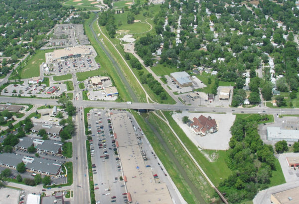
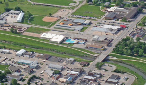
These structures increase the capacity of creeks and streams to carry floodwaters downstream while reducing damage to adjacent properties. These types of structural flood mitigation measures are typically utilized in the lower portion of a watershed to prevent too much flood water from reaching the same place at the same time. The NRD often provides hiking/biking trails atop these structures to offer additional benefits and improve our quality of life.
The Papio-Missouri River NRD currently owns and/or operates more than 90 miles of levees and channel improvements. Listed below are descriptions of ongoing levee and channel improvement projects undertaken by the NRD.
West Papillion Creek Flood Mitigation Project
A levee and channel widening project on the West Papillion Creek in Sarpy County, from approximately 36th Street to 90th Street, was completed in 2001, and provides significant flood protection to the City of Papillion. A channel improvement was completed in 2014 to reduce flooding along the West Branch Papillion Creek from 90th Street to Giles Road. Click here for a fact sheet on the West Branch Channel project.
Big Papio Creek Flood Mitigation Channel Project
Completed from West Center Road downstream to “L” St. at a cost of $13 million, this cooperative project with the U.S. Army Corps of Engineers has greatly reduced the flood potential through one of Omaha’s most flood-prone areas. In addition, the NRD has extended this project upstream by improving the section of the Big Papio Creek from West Center Street north to Blondo Street. Completion of this flood reduction improvement and adjacent hiking/biking trail was accomplished in 2002 at a total cost near $6 million.
Operation and Maintenance
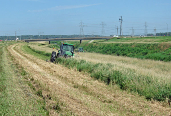
All flood mitigation structures require continuing maintenance to remain safe and effective. Unbridled flood waters possess a destructive power unmatched by other forces in nature. Containing high water flows can best be accomplished with often-inspected, well maintained flood mitigation structures. Our crews inspect and maintain over 80 miles of flood reduction improvements.
Floodplain, Flood Hazard Information Is your property in a Floodplain?
New digital Flood Insurance Rate Maps exist for all areas within the Papillion Creek Watershed ( Douglas, Sarpy, and, Washington Counties). View the links below to determine flood hazard for a specific property or contact the NRD staff listed at the bottom of this page.
- Sarpy County GIS Viewer
- Douglas County GIS Viewer
- FEMA Flood Map Viewer (Washington County plus other areas within the Papio NRD area)
More information on floodplain management throughout Nebraska and the nation can be found at:
NE Department of Natural Resources www.dnr.ne.gov/fpm
Flood Insurance Information www.floodsmart.gov
Federal Emergency Management Agency www.fema.gov
Electronic Flood Warning System
A Flood Warning System for the Papio Creek Watershed was installed in 1994 by the U.S. Army Corps of Engineers to better monitor rainfall and high water in the Big, Little and West Papio Creeks. Now, up to the minute readings along streams are monitored by the National Weather Service and aid in flood detection and early warning. The system has been recently upgraded and is maintained by the US Geological Survey.
For more Information contact:
Amanda Grint
Water Resources Engineer
402-444-6222
agrint@papionrd.org
Lori Laster, CFM
Stormwater Management Engineer
402-444-6222
llaster@papionrd.org


