Below Normal Precipitation and Warmer than Normal Temperatures Will Impact the Platte River
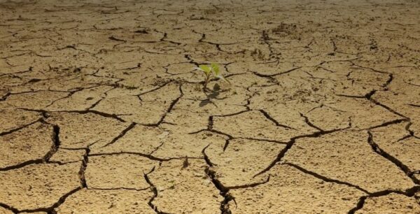
An Eastern Nebraska group, the Lower Platte River Consortium, is encouraging the public to start now in proactively conserving water. Projections show that warmer temperatures and below normal precipitation are expected to continue through at least May and June.
We all rely on Platte River flows. The Platte River is the lifeline for the state of Nebraska. A majority of the population relies on groundwater from wells, which are replenished by the Lower Platte River, including the communities of Omaha, Lincoln, and Fremont. The Platte River also provides habitat for fish and wildlife, recreation, and recharges wells for irrigation in the Platte River valley.

Weather has a big impact on Platte River flows. Contributing factors include runoff from rainfall within the basin and snowpack in the Rocky Mountains near Denver, Colo., and Laramie and Casper, Wyo. Nebraska has experienced an unusually dry fall and very mild winter, with little snow and rainfall. Current conditions in the state are dry, including lower levels of moisture in the soil.
River flows can decrease to the point where the river will not adequately replenish the wells. Flows in the Platte River are currently adequate to recharge our wells; what those flows will be like later if dry conditions continue is unknown.
Current long-range predictions through May and June indicate above normal temperatures, and below normal precipitation for the state. Dry and warm conditions will have an impact on the amount of water in the Platte River that is available for its various needs and uses.
Given the current dryness, the group asks for the public’s assistance now, knowing it is dry, to use only what you need. If dry conditions persist, the group will communicate this and ask additional assistance from the public to conserve water.
“The consortium will continue to work together to monitor and share information with the public as we progress into these spring and summer months,” states Paul Zillig, General Manager of the Lower Platte South NRD. “Our group recognizes the need to be more proactive and communicate with the public so we can all work together to ensure conservation. We need to start now conserving water, knowing that current long-term forecasts are telling us it’s going to get warmer, and we won’t have much rain.”
The Nebraska Department of Natural Resources has launched an online dashboard available to the public that displays real-time information that the department monitors and collects throughout the state. The dashboard includes current up-to-date drought conditions, common drought indicators, and the streamflow projection for Platte River at Ashland. The data reflects the conditions throughout the Lower Platte basin and the entire state. The dashboard also provides important links to other local and national climate-related resources. The department will continue to closely monitor streamflow conditions throughout the summer.
To view the dashboard, visit the Department of Natural Resources’ site: (dnr.nebraska.gov/water-planning/lower-platte-river-basin).
The Lower Platte River Consortium will continue to monitor the conditions and its entities will work with individuals and communities to conserve water as necessary.
About the Consortium
Formed in 2016, the consortium consists of six different entities (agencies) that monitor and rely on the Lower Platte River for their water supply. These agencies include:
- Lower Platte South NRD
- City of Lincoln Water System
- Lower Platte North NRD
- Nebraska Department of Natural Resources
- Papio-Missouri River NRD
- Metropolitan Utilities District
 The Papio-Missouri River Natural Resources District (Papio NRD), the Nebraska Department of Natural Resources (NeDNR) and FEMA will host two public open houses this month to give property owners the opportunity to talk to experts about new draft flood maps, learn about their flood risk and ask floodplain-related questions.

